
GET DIRECT INSIGHTS WITH ADVANCED CONSERVATION TECHNOLOGY TO MAKE ACCURATE & INFORMED DECISIONS
And say goodbye to the hassle of merging data from multiple sources.
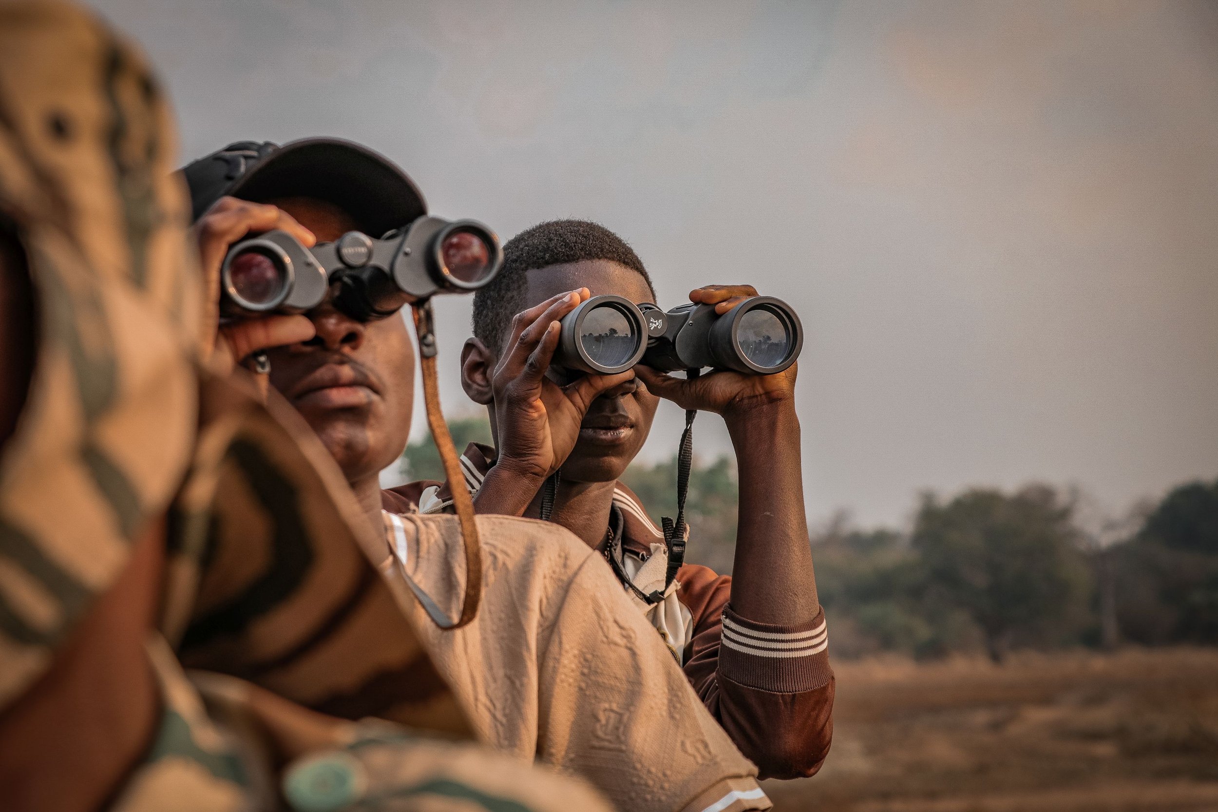
Monitor wildlife, activities and landscapes, and track in real-time to enhance overall productivity.
Get a 360-degree bird’s-eye view with Focus 360: Our real-time monitoring and situational awareness technology gives you instant access to all your data in one harmonised platform — delivering answers to the Six Key Investigative Questions (What, Where, When, Who, How, Why) in seconds.

Impact Dashboards & Reports: Transform real-time monitoring into meaningful insights with live dashboards and stakeholder-ready reports — providing transparent and comparable insights across all your projects.
Track change over time with the Environmental Time Series Analysis: Monitor landscape dynamics over time using conservation technology with satellite data.
Real-Time Tracking & Alerting: Track sensors live and send targeted warnings, alerts, or updates - exactly when and where they’re needed.


Get real-time & historical data at your fingertips
Answer ad-hoc questions in under a minute
Integrate data from multiple sources
HOW OUR PARTNERS USE MONITORING & INSTANT INSIGHTS

“Sensing Clues' real-time insights and reports are vital in our fight against rhino poaching, providing us with instant access to the information we need.”
Black Mambas all women APU, South Africa
WILDLIFE PROTECTION


“Using the Sensing Clues platform and tools, we gained valuable insights into large carnivores and achieved results that made a real difference.”
WWF, Ukraine
HUMAN-WILDLIFE COEXISTENCE
Fast as lightning.
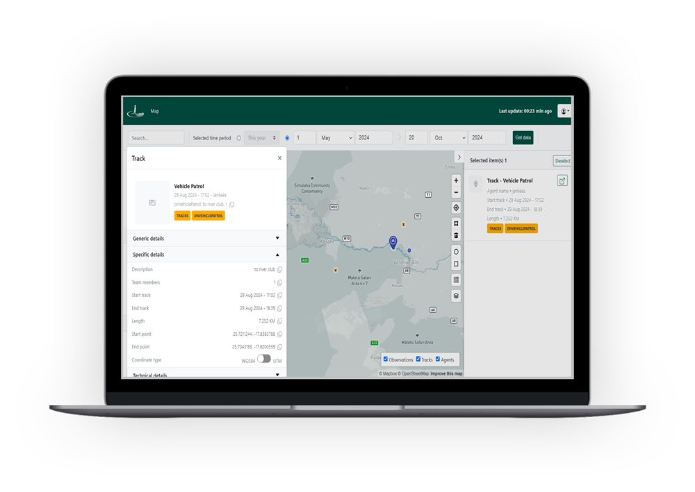
With Focus 360, our intelligent monitoring and situational awareness technology, you get instant access to all your real-time and historical data. Efficiently track activities, monitor wildlife, team members, and assets. Rely on facts, not assumptions, for informed decision-making.
Impact Dashboards for real-time visibility.
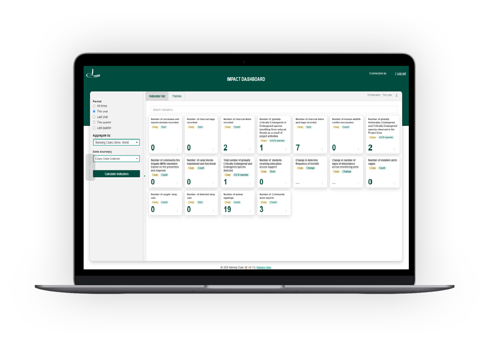
See the impact of your conservation efforts instantly across all your projects with the Standard Impact Dashboard included in Sensing Clues Central. Upgrade to Premium for customised real-time dashboards and stakeholder-ready impact reports.
Track landscape changes over time.
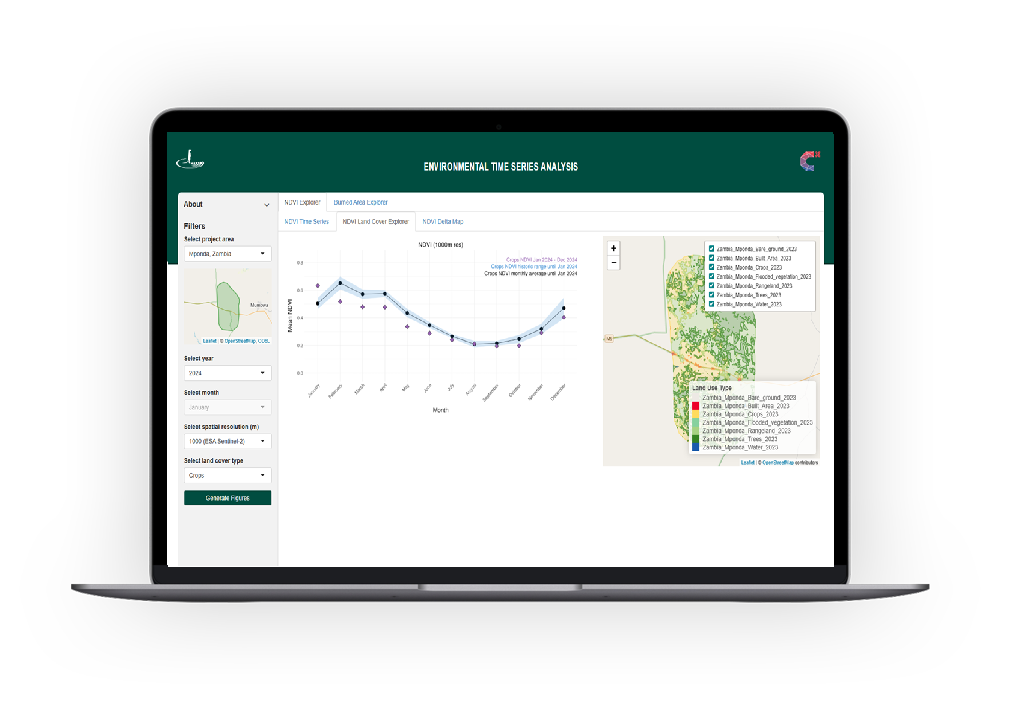
Our Environmental Time Series Analysis lets you monitor environmental change over time - whether it’s vegetation health, deforestation and reforestation, drought, floods, burned areas or urban expansion - using satellite data and intuitive charts, maps, and land-cover insights. Get clear, actionable visuals to support smarter decisions in seconds.
Tackle specific ad hoc questions with ease.
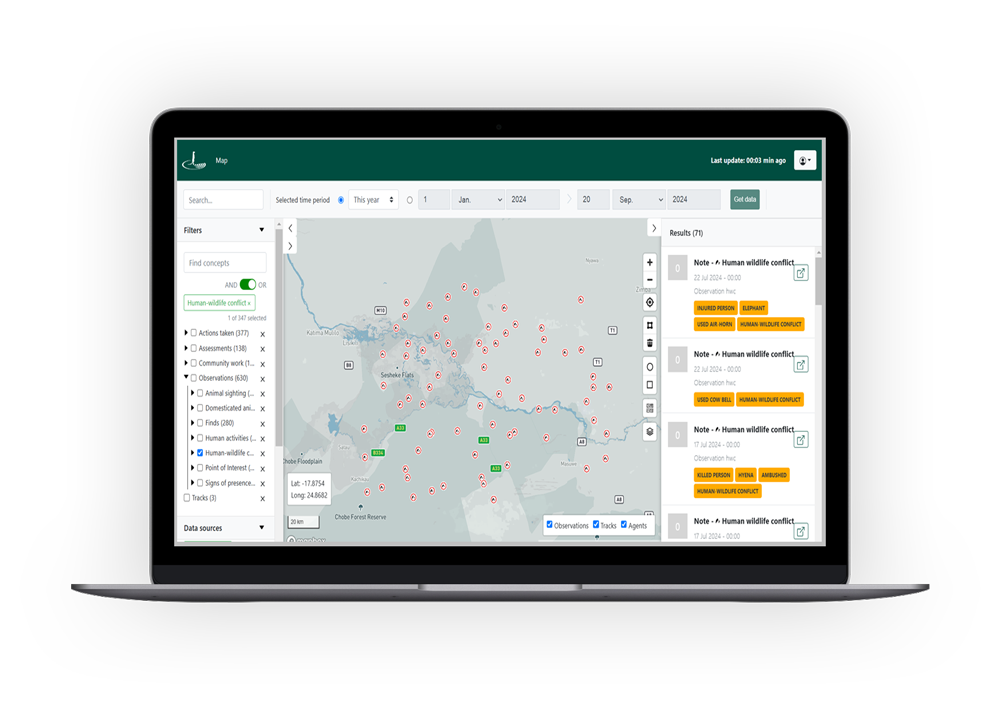
If answering questions from managers and stakeholders takes hours or days instead of just one minute, it’s time to switch to Focus 360. Our AI-driven conservation technology provides the specific insights you need to tackle your conservation problems effectively by answering the Six W's of Investigation: What, Where, When, Who, How and Why.
Custom alerts in real-time.
Track sensors live and respond instantly with targeted alerts, warnings, or updates - where and when they matter most. With the Real-time Tracking & Alerting conservation technology toolset, you’re in control: create and manage your own rules in just a few clicks, no coding required.
WHAT OUR PARTNERS SAY
-
![]()
“The communication role that the Cluey app plays, has changed the way we operate, resulting in instant responses.”
Keith, Head Pilot Anti-Poaching Air Wing, Wildlife Works, Kenya
-
![]()
“Thanks to Sensing Clues, we have seamless data synchronisation and easy access to real-time insights from our field partners, enabling more informed decision-making.“
Roman, Project Officer Wildlife, WWF, Ukraine
-
![]()
“Thank you for going the extra mile: Your personal support is outstanding, and being available 24/7 makes all the difference!”
Craig, Managing Director, Black Mambas all women Anti-Poaching Unit, South Africa
-
![]()
“Sensing Clues has provided invaluable technical support, enhancing our efforts to protect elephants and engage local communities.”
John, Data & Research Coordinator, Wild Survivors, Tanzania
-
![]()
“The Sensing Clues platform is an exceptionally powerful and invaluable tool for harmonising data, monitoring biodiversity, and managing protected areas.“
Boris, Head of Technology Area, 3edata, Spain
-
![]()
“Cluey is the best app I’ve ever used for data collection.“
Nikola, Researcher and Fauna expert, Bulgarian Academy of Science and Vitosha Nature Park Directorate, Bulgaria
-
![]()
“Cluey is extremely user-friendly and requires no technical expertise.“
Cristian, Wildlife and Landscapes National Manager, WWF, Romania
-
![]()
“In one or two clicks I get a summary of all I want to know about any incident. Awesome!”
Moses, Lead Analyst, Wildlife Works, Kenya
-
![]()
“Sensing Clues offers us a powerful platform for data management and analysis.”
Tom, Director, Nsanga Conservation, Zambia
Simplified
SEAMLESS INTEGRATION WITH ALL YOUR EXISTING TOOLS.
Our conservation technology solutions effortlessly connect with your existing data, collection tools, and third-party services. It includes uploaded spreadsheets, map layers, ODK surveys, camera-trap images, IoT sensors, trackers, Global Forest Watch alerts, and anything more of interest for you. This integration allows all your tools to work together efficiently, simplifying the process of gathering and analysing your data in one convenient platform.

TURN YOUR DATA INTO USEFUL INSIGHTS IN MINUTES
Make quick decisions and tackle any ad-hoc questions with ease. Try Focus 360 for free.
