
COMMUNITY-LED LAND-USE MANAGEMENT
Helping communities make informed decisions about their land, using habitat and land-use maps.
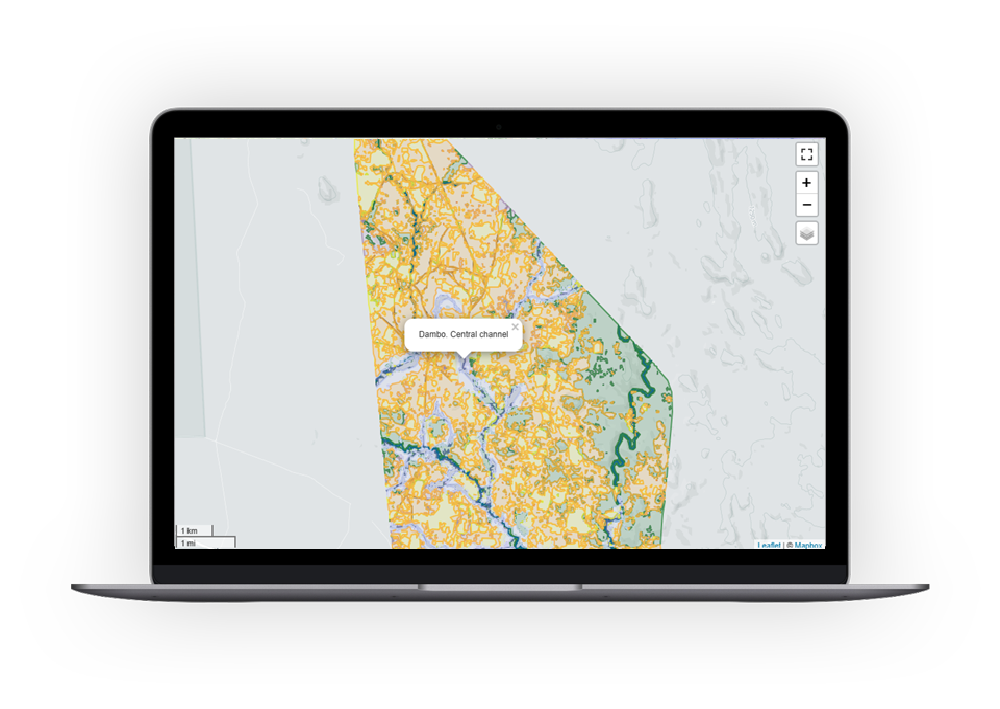
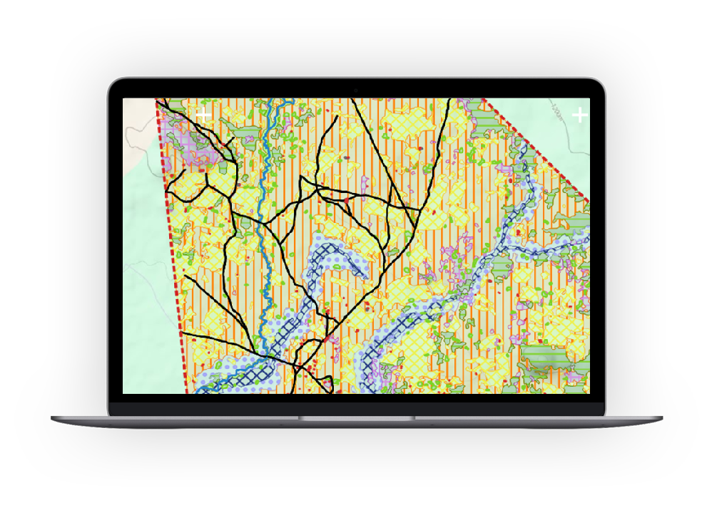
Clear maps for smart & inclusive land-use decisions.
Community-led land-use management means that local communities decide how land is used, protected, and shared. This process has two parts:
Land-use planning: agreeing together how land should be used.
Land-use mapping: showing this information clearly on maps.
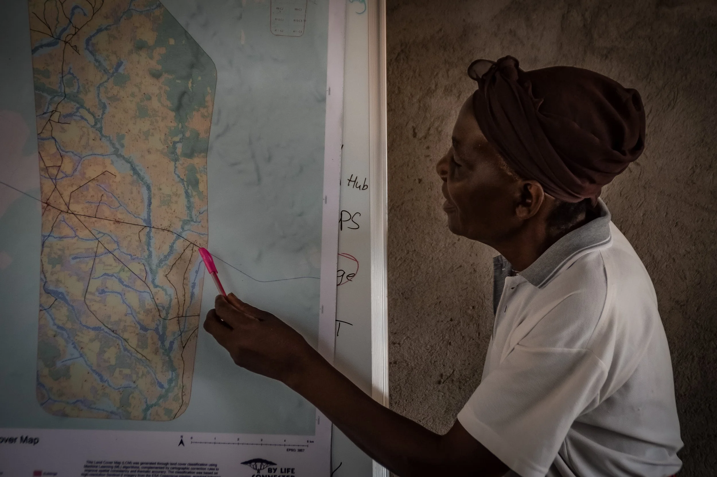
Sensing Clues supports communities by providing accurate land-use and habitat maps. These maps make it easier to understand the landscape, discuss options, plan targeted conservation strategies, and make fair and informed decisions.
Our maps help answer crucial questions such as:
What types of land and habitats are here?
Where can farming, housing, or conservation take place?
Which areas should be protected or restored?
In Zambia, we work with By Life Connected, who lead the community-led land-use planning process, while Sensing Clues provides the mapping support.
INTERESTED IN COMMUNITY-LED LAND-USE MANAGEMENT?
Land-use maps and habitat maps are services included in our customisable Premium Plan.
LAND-USE & HABITAT MAPS
Land-use maps show how land is used (e.g. farming, settlements, forests) and are faster and more affordable to produce. Habitat maps are more detailed and focus on natural habitats, supporting conservation decisions.
Unlike free global maps (e.g. from Google Earth Engine), which are often outdated and less detailed, Sensing Clues maps are based on local knowledge and ground-truth data and are regularly updated.
The creation of a habitat and land use map is a highly interactive process involving you as the local expert, our Solution Partner 3edata for the classifications, and the Sensing Clues team.
-
The specific area for mapping is determined.
-
Sensing Clues’ Ecosystem Base Map is used to gather satellite data and produce cloud-free mosaics.
-
False-colour imagery is employed to identify areas for ground-truth validation, with these locations marked in our data collection app Cluey.
-
Ecologists then visit these marked locations to verify and classify the habitat.
-
3edata uses the collected data to develop a habitat classification model and create an initial map.
-
Knowledge rules are applied to improve the classification results and generate the final habitat map.
CREDITS
Land-use and habitat mapping routines have been developed by Nature FIRST, a Research and Innovation Action (RIA) from HORIZON-CL6-2021-BIODIV-01-02 Call (grant Agreement ID 101060954) that has received funding from the European Union’s Horizon Europe Research and Innovation programme.
