
CONNECTING DATA FOR BETTER MEADOWBIRD PROTECTION
Insights from Melanie Arp and Maitreyi Sur on the Boeren, Burgers en Buitenbeesten project
The Boeren, Burgers en Buitenbeesten project, led by Hogeschool Van Hall Larenstein, brought together researchers, conservation organisations, agricultural collectives and technology partners. Together, they developed a prototype information system that integrates data from multiple sources to support data-driven meadowbird management, with a particular focus on predator pressure. As part of the project, Sensing Clues supported the technical development and implementation of the application, working closely with the project team to turn field observations into a more accessible and actionable view of where risks to meadowbirds may be highest.
In the interview below, Maitreyi Sur, who worked on the scientific background, modelling and technical implementation from Wageningen University and Research, and Melanie Arp, who provided technical support, information system development and coaching from Sensing Clues, reflect on the project, the role of data integration, and what the prototype could mean for future meadowbird conservation.
1. Maitreyi, what was the main challenge the Boeren, Burgers en Buitenbeesten project set out to address?
Meadowbirds are an iconic part of the Dutch agricultural landscape, yet their populations have been declining for decades despite extensive conservation efforts. Predation is one of the factors affecting their breeding success, but understanding where and when predators pose the greatest threat remains a challenge. Predation depends on several interacting factors, including landscape characteristics, weather, habitat management and the time of year. Although large amounts of ecological data are collected, these often remain scattered across different monitoring systems. The project explored how these fragmented observations could be combined into a digital twin of the landscape, helping to estimate where predators are likely to occur and how predation risk changes across space and time. Ultimately, the ambition is to help conservation managers anticipate potential threats rather than only responding after the damage is done, providing better tools to protect meadowbirds when they are most vulnerable.
2. Maitreyi, why is integrating different data sources so important for meadowbird conservation and how does the information system bring these different observations together?
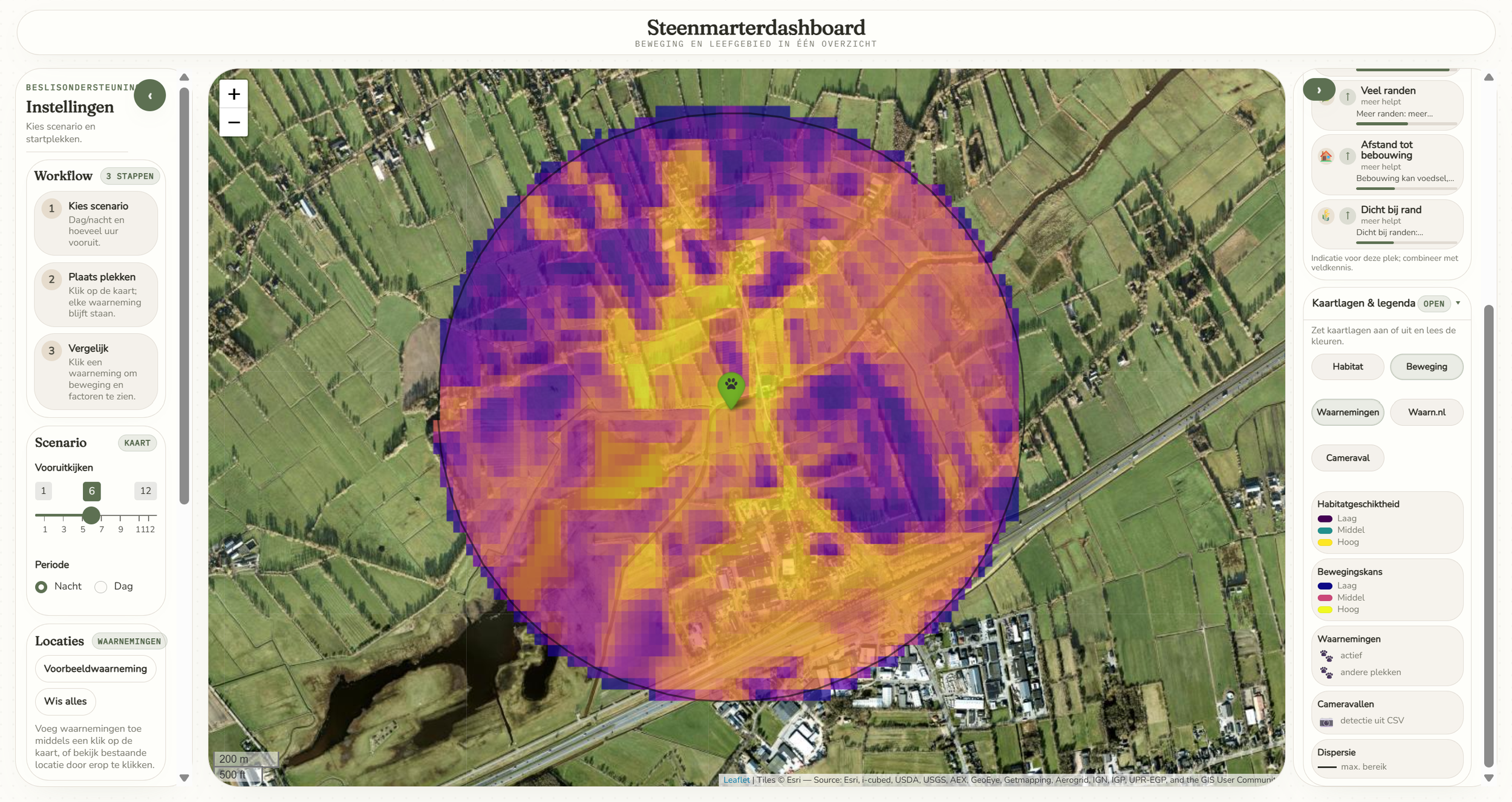
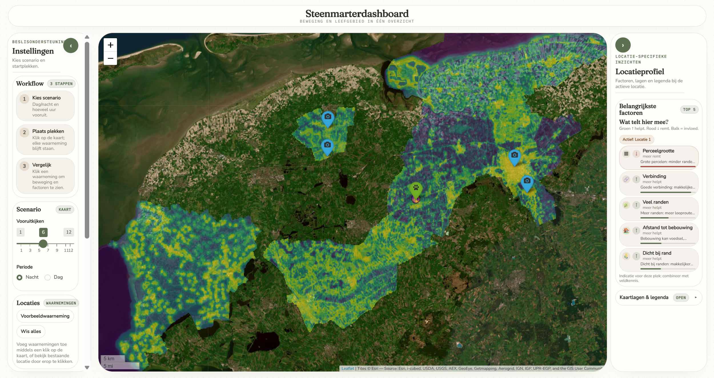
No single data source can tell the whole story. Citizen science observations tell us where predators have been spotted, camera traps provide local evidence, and GPS tracking reveals how individual predators move. Landscape features and weather conditions help explain these patterns. Each source offers a different piece of the puzzle, but also has its own limitations. To bring these pieces together, the project developed two complementary digital twin models. PREDMAP combines wildlife observations with landscape characteristics and seasonal patterns to estimate where predators are likely to occur. FarmPredatorFlux focuses on predator movement, using GPS tracking and habitat information to model how predators move through agricultural landscapes under different scenarios, including day and night. In collaboration with Sensing Clues, these models were translated into interactive beta dashboards. Users can explore locations, investigate potential predator movement patterns across different time periods, and examine the environmental factors shaping the model outputs. By comparing these results with field observations and local knowledge, conservation managers can identify areas that may need closer attention and refine their understanding as new data becomes available.
3. Melanie, what role did Sensing Clues play in turning the project's scientific concept into a practical application?
Sensing Clues brought experience from projects such as the Crane Radar and Human-Bear Conflict Radar, where we combine different data sources with expert knowledge and present the results with the end user in mind. For the Boeren, Burgers en Buitenbeesten project, we applied this experience to help translate the scientific concept into a practical application that can support real-world conservation decisions. An important part of our role was also to think about how the prototype could remain future-proof. The application needs to handle increasing amounts of data while keeping the user experience responsive and, where possible, close to real-time. This meant working closely with the project team on how the scientific modelling and data could best support the needs of the end users.
4. Melanie, how can the prototype help inform meadowbird conservation planning and management?
Similar to the Human-Bear Conflict Radar, which combines risk information to help project managers identify where proactive measures are needed with real-time sightings that can indicate likely animal movements and support an immediate response, the Boeren, Burgers en Buitenbeesten prototype can support both long-term planning and short-term responses to predation pressure. In the long term, it provides insights into where and when the risk to meadowbirds is highest. This can help farmers and land managers plan where and when conservation measures and resources, such as barriers, may be most needed. In the short term, new observations can provide more immediate information. For example, a predator sighting from a camera trap could indicate potential movement patterns, while a known meadowbird nest could be assessed for its level of predation risk. This information can help farmers and land managers respond with more targeted and timely measures.
5. Maitreyi and Melanie, now that the project has come to an end, what are the most important lessons you take away, and what would you like to see happen next?
Maitreyi: One of the key lessons is that more data does not automatically mean better information. The real challenge lies in connecting different sources, understanding their limitations and translating the results into insights that are useful for conservation practitioners. We also learned how important it is to involve end users from the start, ensuring that the tools address their practical needs. The next step would be to develop the prototype into a practical decision-support system, incorporating automated monitoring and allowing users to explore the potential effects of different management measures. Ultimately, the goal is not just to predict where predators might occur, but to help conservation managers decide what action to take and evaluate whether it works.
Melanie: Feedback from the field partners gave us valuable insights into how they interact with the application and what they need to feel confident using it. One important takeaway was that users would benefit from a better understanding of how the current risk map is built and how the different factors contribute to the result. Looking ahead, there was also strong interest in the possibility of adding scenario analysis – for example, exploring what effect a predator barrier might have in a specific area. This could help farmers and land managers plan and compare different measures before putting them into practice.
Background Information
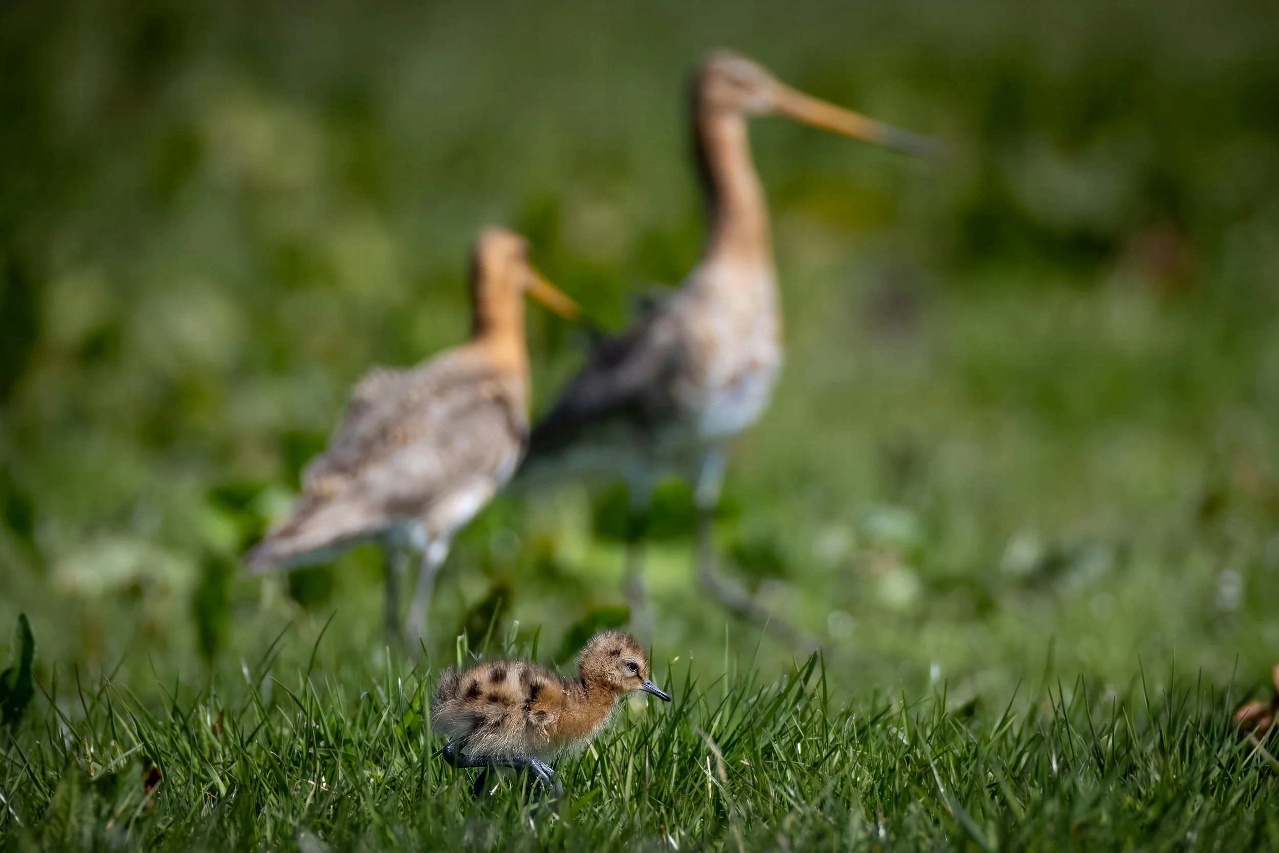
The Boeren, Burgers en Buitenbeesten project, led by Hogeschool Van Hall Larenstein, explored how data and technology can support the protection of meadowbirds in agricultural landscapes. The project focused on combining field observations, information on predator pressure, habitat and land management to better understand where risks to meadowbirds are highest and support more informed conservation decisions. The prototype information system allows users to visualise observations and identify spatial patterns. Camera traps were also explored as a potential additional data source for future monitoring.
Sensing Clues contributed technical support, application development and coaching, with Melanie Arp working closely with Maitreyi Sur on the scientific and technical implementation. The project brought together researchers, farmers, conservation organisations and technology partners to explore how better-integrated data can support practical meadowbird conservation.